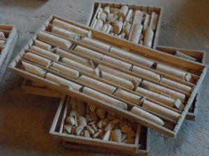
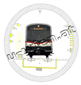
Knowing the precise geological conditions is of key importance to the people planning a tunnel construction. Where can you find fine-grained, soft and plastic rock, such a clay-like soil? Where does the subsoil turn into sandy gravel? At what depths and in which stone layers can groundwater be expected, and how can this be managed during construction work?
And finally, where could there be areas of significant artificial backfill, such as in a former glacis? These issues determine the route of the tracks taken, construction methods used and safety measures required. Illustrating the geological conditions on maps and using models is a key part of planning the construction of an underground line.
The geology of Vienna
Vienna has the share of several geological formations. The Alps occur in the Flysch zone and the Limestone Alps in the west and north. The sediments of the Vienna Basin originate from a sea, the Parathetys, which covered the Vienna area about 16 to 9 million years ago.
Traces of the ice ages have also been preserved. Cold and warm periods have alternated. Gravel terraces with loess are remnants of this period. They are partly recognizable as terraces, as at the Strudelhofstiege in the 9th district or in the form of the Stadtterrasse in the city center.
After the ice ages (i.e. for about 11,500 years) the Danube formed a branched water network (zone of recent meanders), which was straightened and regulated by the Danube culvert at the end of the 19th century.
Geology
Fossil wood
Age: 11.5 to 10 million years
Wood occurs repeatedly in the silt layers of the Pannon. These are wood remains deposited in the sediment, where the process of transformation into charcoal has already begun or has progressed.
Limnocardia
Age: 10 million years
The Limnocardia belong to the mollusks and lived in the lake that covered large parts of eastern Austria during the Pannonian.
The Limnocardia form a marker horizon in the silt/clays of the Pannon. That means they occur in a certain layer, clustered.
About 10 million years ago, seasonal fluctuations in precipitation, which caused high nutrient input, favored the spread of limnocardia.
Melanopsids
Age: 11.5 to 10 million years
Melanopsids belong to the crown snails. During the Pannonian, the estuaries and coastal marshes were colonized by them.
Soil type
- Loam: as a mixture of sand, silt and clay with approximately equal proportions.
- Clay: diameter smaller than 2 µm (equivalent to 0.002 mm)
- Silt: diameter from 0,002 to 0,063 mm
- Sand: diameter from 0,063 to 2 mm
Soil types can be, among others
- Stream gravel
- block
- clay
- loess
- Quartz gravel
- Sand (fine, medium, coarse)
- Sandstone gravel
- Silt (fine, medium, coarse silt)
- Crushed stone
- Alluvial fan sediments
- Alluvial fan sediments/loess loams
- Vienna Basin Sediments
- and many more
Groundwater
Groundwater
A large-scale contiguous groundwater body, very productive compared to stratum water.
Groundwater presents a special challenge for subway construction. It can exist in different forms, with different movements and with different pressures.
In the area of the U2 line Neubaugasse to Schottentor, the hydrologists identified three different situations:
- In the area of the town hall, the tunnel floor lies in the Danube gravel. Here, the underground Danube tributary leads to a very productive, contiguous groundwater reservoir.
- The Neustiftgasse is the deep channel of the former stream. Through its valley bottom, waters find their way into the depths. These low-yielding “slope waters” can reach the area of the tunnel tubes from above.
- The subsoil of the seventh district consists mainly of silts and clays. These relatively soft, groundwater impounding sediments are rather favorable for subway construction. Embedded in sand and gravel layers, “stratum waters” also occur here, but these are not very productive.
Slope water
As a special case of stratum water, this water moves along damming layers.
Stratified water
Local and stratum-bound, low-yielding groundwater.


